|
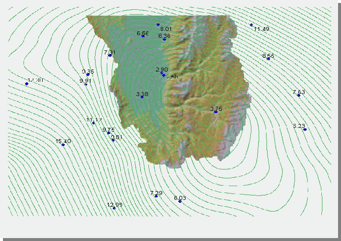
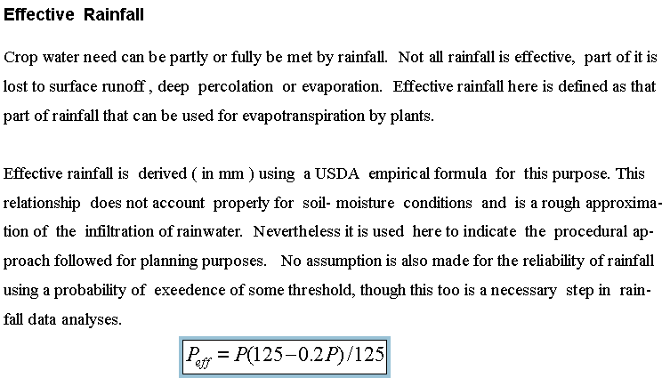
Rainfall data from weather stations
is similarly interpolated and used to obtain
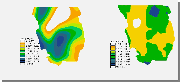
Effective rainfall for each month.
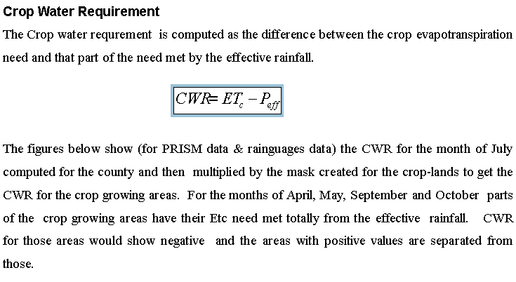
Precipitation data in GIS format is also available
from PRISM (Oregon State University- web site) and is compared
below with the interpolated data from the
rainguages. The mean values for July in mm/day are
.823 and .721 , (the max a.434 and 1.656) for the PRISM data
and the guage data respectively. The PRISM data seems to
account for the orographic effect caused by the mountains
bordering Cache valley and there is a noticeable difference in
the rain distribution. Spatial averaging of the data from the
rainguages using an interpolation technique which
takes into account the elevation is an ideal approach not used
in this project.
|
|