What to do if you have ArcView but do not have ArcInfo
ArcInfo function
Coverage tools → Conversion → To Coverage → Import From Interchange File.
ArcView Workaround:
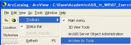
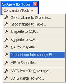
ArcCatalog → View → Toolbars → ArcView 8x Tools → Conversion Tools → Import from Interchange File
ArcInfo function
Projections and Transformations → Rater → Project Raster.
ArcView Workaround
Option 1. On the fly projection with Export Data.
Display the raster as a layer in a data frame that has projected coordinates.
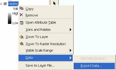
Right click Layer → Data → Export Data. At the dialog that appears specify the spatial reference to be the current data frame. Specify the cell size as desired.
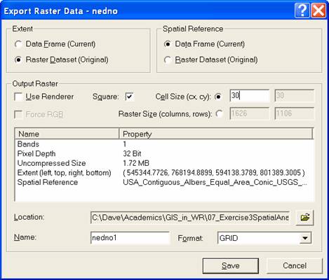
This approach does not allow the user control of the resampling technique (presumably the default is nearest neighbor)
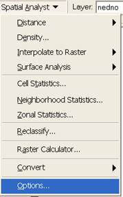
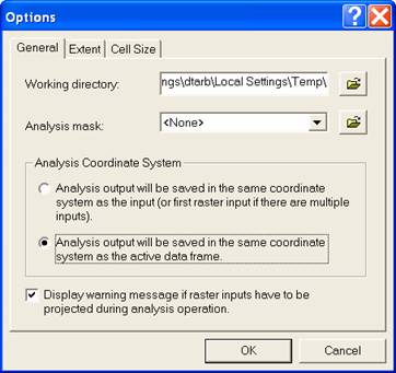
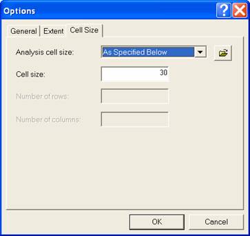
Option 2. On the fly projection with Raster Calculator. Display the raster as a layer in a data frame that has projected coordinates. Set spatial analyst options to designate the output coordinate system the same as the active data frame and cell size of the output as specified then 'evaluate' an expression that is simply the grid that needs to be projected.
|
|
|
This approach does not allow the user control of the resampling technique (presumably the default is nearest neighbor)