Exercise 2 Correction
A number of students reported problems with the use of Model Builder to create the Monitoring point feature class on page 29 of Exercise 2. There is an error in the exercise description that is corrected here. We also present a more intuitive approach using the Graphical User Interface (GUI) that Dr. Maidment showed in class as an alternative. The model builder approach is useful for automating tasks if this work is to be done repeatedly, but if you are only doing it once the GUI approach is better.
Correction to Model Builder sequence on page 29.
At step (7) in the Toolbox window browse to Data Management Tools à Features à Copy Features (not Data Management Tools à General à Copy) and drag this tool on to your model as before. Proceed with steps as before.
Alternative approach that uses the GUI rather than Model Builder.
(1) Open ArcMap and the Ex2.mxd file you created in the first part of this exercise. Add the latlong.dbf table created in Excel.
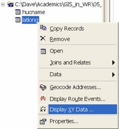
(2) Right click on the latlong entry in the table of contents and select "Display XY Data…"
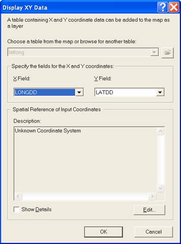
(3) In the dialog box that appears adjust the X field to LONGDD (for longitude) and the Y field to LATDD (for latitude). Click on Edit to adjust the Spatial Reference coordinate system.
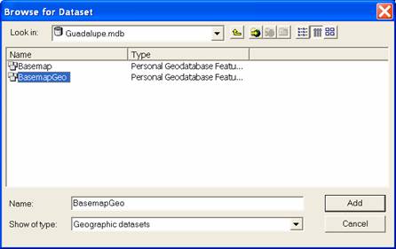
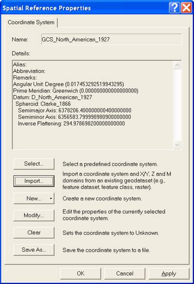
(4) In the Spatial Reference Properties dialog box that appears click on Import and browse to the BasemapGeo feature dataset. This imports the spatial reference projection information from this feature dataset.
Click Add, and OK twice to dismiss the dialog boxes that are open. A layer named "latlong events" should be added to your map display. This now needs to be converted into a feature class.
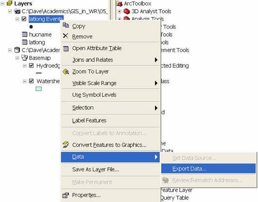
(4) Right click on "latlong events" in the table of contents and select Data à Export Data
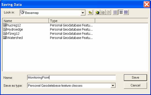
In the dialog box that appears browse to save the data you are exporting as a feature class named "MonitoringPoint" in the Basemap feature dataset.
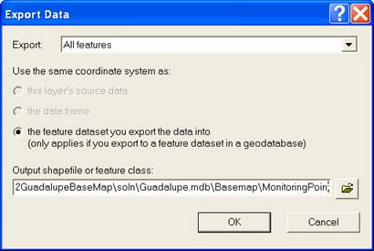
Click Save, OK and Yes to the prompt to add the data to the map as a layer. The projection from geographic coordinates in the Latlong events layer to Albers spatial reference coordinates in the Basemap feature dataset is done on the fly as the MonitoringPoint feature dataset is written.
At this point the Monitoring point feature class should be added to your map display. Save your Ex2.mxd ArcMap document and proceed with the remainder of the steps in the exercise (starting on page 30).